About
The project that became the Local Geohistory Project started with a simple question posed in 2009 – how did a community acquire its name? I thought the answer would be found with a quick visit to the county archives, something I had done many times before. I quickly learned the challenges that faced researchers in Pennsylvania trying to discover how their communities' boundaries and form of government evolved over time, given that the county office that most often handled these matters is now primarily concerned with maintaining criminal records.
Over the next few years, the project's scope went from countywide to statewide, and then expanded to New Jersey. After a decade of research, data for the Local Geohistory Project was made publicly available online for Pennsylvania and New Jersey, and additional states are planned to be added in the coming years. My goal is to give other researchers the tools to understand how their own communities grew, both through maintaining citations to pertinent records and, where feasible, mapping boundary changes.
The following demonstrations show different ways that Local Geohistory Project data can be used to illustrate growth and change in communities over time.
Mapping Growth
The Borough of Lansdale is located in north-central Montgomery County, Pennsylvania. The borough was incorporated in 1872, and its charter is found at the Recorder of Deeds of Montgomery County in Miscellaneous Book 16, page 16. Since that time, the borough limits have expanded by over over six (6)-fold.
GeoJSON files available for download on the project website contain information about boundary changes where mapping is complete. Because Lansdale has never lost territory, we can show the borough's growth easily on a static map.
For more information about Lansdale's boundary changes, visit the Lansdale page on the project website.
Mapping Change
The Borough of Somerset is the county seat of Somerset County, Pennsylvania. Incorporated in 1804, the borough became the home to a stop on the Pennsylvania Turnpike when it annexed territory to the north in 1942, less than two (2) years after the turnpike opened in 1940. The borough limits have expanded numerous times, increasing its total size by over three (3)-fold.
Unlike Lansdale, Somerset lost territory early in its existence (which it later re-annexed). The following is an example of one of over 1,000 boundary change animations available through the project website for municipalities across Pennsylvania.
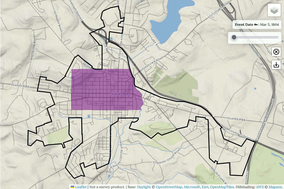
For more information about Somerset's boundary changes, visit the Somerset page on the project website.
Open Data
Want to do more with the data? Visit the Open Data Github repository for source code and database extracts!